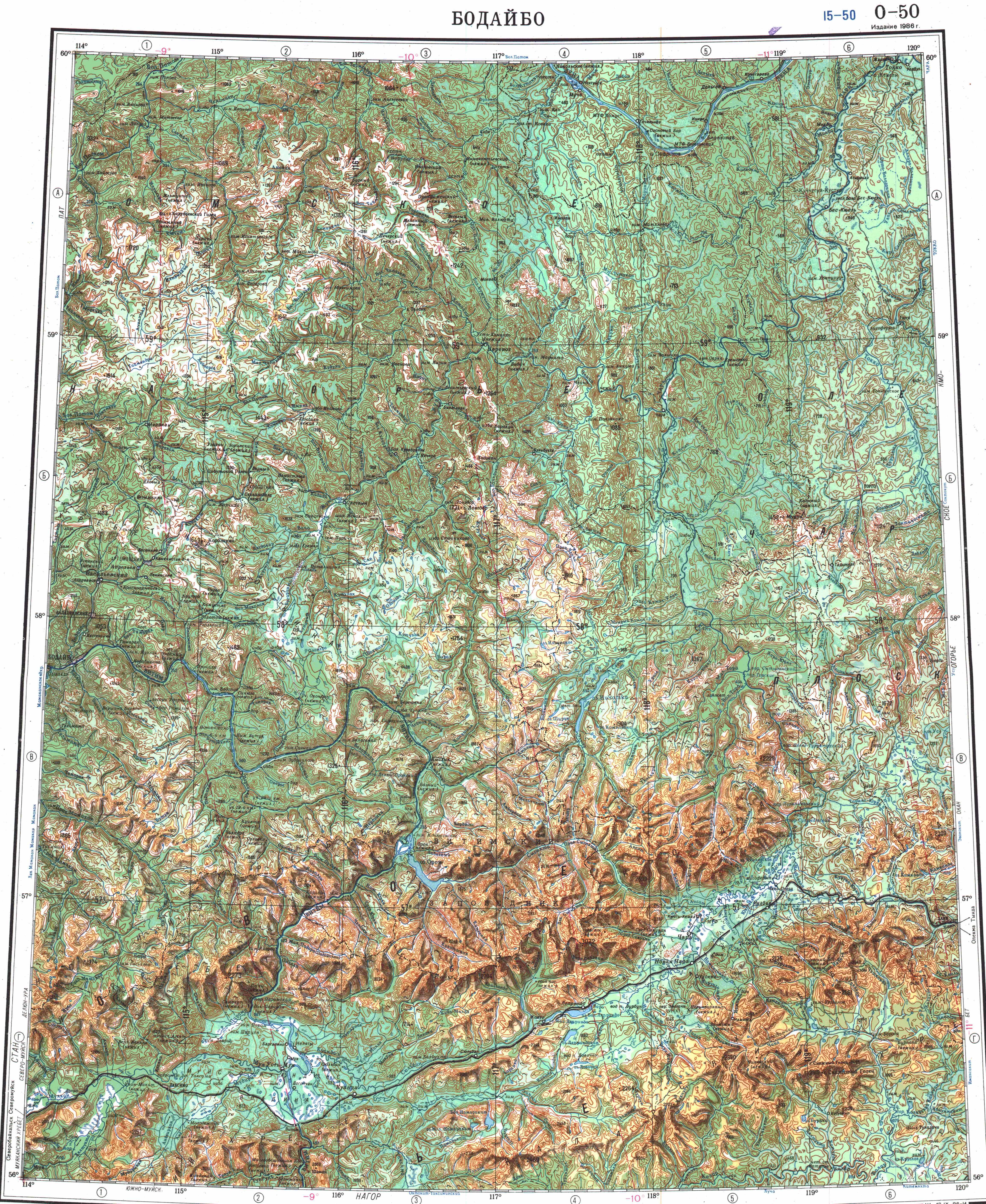
Kropotkin Range
Kropotkin Range ( ) is a mountain range in Bodaybinsky District, Irkutsk Oblast, Russian Federation.
≈ 2 min read
Names in other languages
No names in other languages are held for this entry yet.
Article bodies are English and are not machine-translated. A name in another language is not a translation of the article.
Kropotkin Range ( ) is a mountain range in Bodaybinsky District, Irkutsk Oblast, Russian Federation. The settlements of Kropotkin and Artyomovsky are located in the area of the range.
History
In the course of the 1901 exploration of the Lena Goldfields led by Vladimir Obruchev, the area was first explored, studied, topographically photographed and mapped by Russian geologist and topographer Pavel Preobrazhensky. He named the mountain range in honor of Peter Kropotkin in 1902.
Geography
The Kropotkin Range rises to the north of Bodaybo, stretching roughly for about in a NW to SE direction from the southern part of the Patom Highlands, roughly parallel to the course of the Vitim River to the southwest and west. The slopes of the Kropotkin Range are dissected by wide river valleys. The range summits are generally rounded and of moderate height. The highest peak is high Golets Korolenko, a ‘’golets’’-type of mountain with a bald peak.
Hydrography
The Zhuya river, a left tributary of the Chara, has its sources in the eastern slopes and limits the range in its southeastern section. From the southern slopes originate a few right tributaries of the Vitim, all of them small and short, such as the Takhtiga. In the northern slopes are the sources of some left tributaries of the upper course of the Bolshoy Patom, such as the Anangra and Mara.
Flora
The lower slopes of the range are mainly covered by pine and larch taiga, with mountain tundra and band thickets of dwarf cedar at higher elevations.
See also
List of mountains and hills of Russia
External links
Семья поднялась на хребет Кропоткина за посланием 30-летней давности ceb:Khrebet Kropotkina (kabukiran sa Rusya, Irkutskaya Oblast') pl:Góry Kropotkina ru:Хребет Кропоткина (Патомское нагорье)
Text derived from https://en.wikipedia.org/w/index.php?oldid=1369423035 under CC BY-SA 4.0; modifications have been made.