Puʻu ʻŌʻō
≈ 2 min read
Names in other languages
No names in other languages are held for this entry yet.
Article bodies are English and are not machine-translated. A name in another language is not a translation of the article.
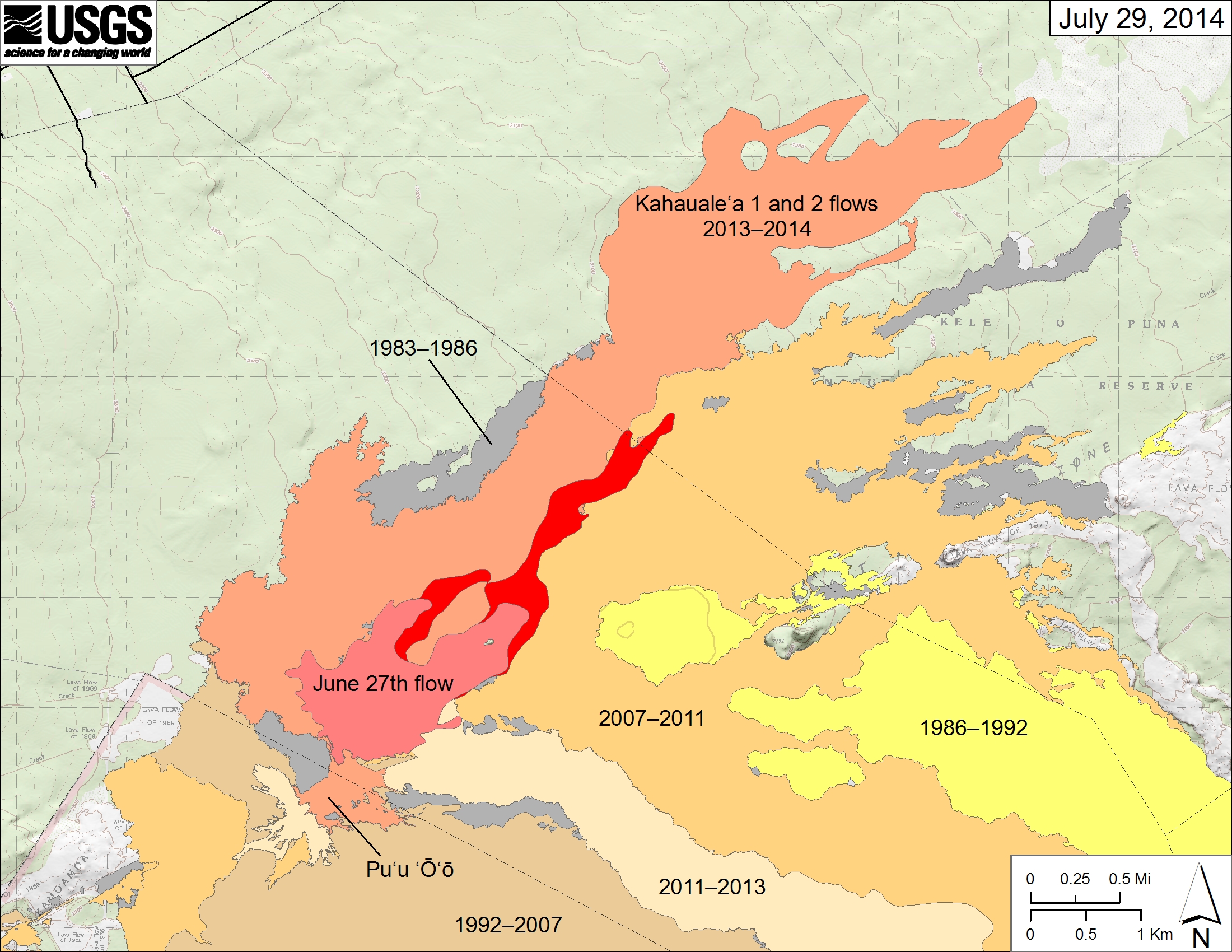
Pu u Ō ō (also spelled Pu‘u‘ō‘ō, and often written Puu Oo, , ) is a volcanic cone on the eastern rift zone of Kīlauea volcano in the Hawaiian Islands. The eruption that created Pu u Ō ō began on January 3, 1983, and continued nearly continuously until April 30, 2018, making it the longest-lived rift-zone eruption of the last two centuries. By January 2005, of magma covered an area of more than and added of land to the southeast coast of Hawai i. The eruption claimed at least 189 buildings and of highways, as well as a church, a store, the Waha ula Visitor Center, and many ancient Hawaiian sites, including the Waha ula heiau. The coastal highway has been closed since 1987, as parts of the road have been buried under lava up to thick.
Pu u Ō ō (also spelled Pu‘u‘ō‘ō, and often written Puu Oo, , ) is a volcanic cone on the eastern rift zone of Kīlauea volcano in the Hawaiian Islands. The eruption that created Pu u Ō ō began on January 3, 1983, and continued nearly continuously until April 30, 2018, making it the longest-lived rift-zone eruption of the last two centuries. By January 2005, of magma covered an area of more than and added of land to the southeast coast of Hawai i. The eruption claimed at least 189 buildings and of highways, as well as a church, a store, the Waha ula Visitor Center, and many ancient Hawaiian sites, including the Waha ula heiau. The coastal highway has been closed since 1987, as parts of the road have been buried under lava up to thick.
Text derived from https://en.wikipedia.org/w/index.php?oldid=1378915705 under CC BY-SA 4.0; modifications have been made.