Teraina
≈ 5 min read
Names in other languages
No names in other languages are held for this entry yet.
Article bodies are English and are not machine-translated. A name in another language is not a translation of the article.
Teraina (written also Teeraina, also known as Washington Island – these two names are constitutional ) is a coral atoll in the central Pacific Ocean and part of the Northern Line Islands which belong to Kiribati. Obsolete names of Teraina are New Marquesas, Prospect Island, and New York Island. The island is located approximately 4.71° North latitude and 160.76° West longitude. Teraina differs from most other atolls in the world in that it has a large freshwater lake (Washington Lake), an open lens, concealed within its luxuriant coconut palm forest; this is the only permanent freshwater lake in the whole of Kiribati. Measuring about NW-SE and SW-NE, it has a land area of about ; its circumference is about . The island is generally low-lying, with a maximum elevation ASL of about , while most of the island rises some high; trees in the dense inland forest grow to several times this height however. At the western end of the island is the capital, Tangkore (or Tengkore). There are (as at the 2020 Census) about 1,893 inhabitants1, making it the least-populated of the permanently inhabited Northern Line Islands. However, population density (177 per km 2 ) is three times as high as on Tabuaeran and vastly more than on the much larger (300-plus km 2 ) Kiritimati with its about 15 people1/km 2 .…
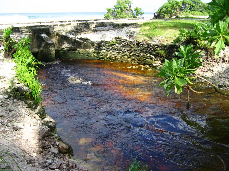
Teraina (written also Teeraina, also known as Washington Island – these two names are constitutional ) is a coral atoll in the central Pacific Ocean and part of the Northern Line Islands which belong to Kiribati. Obsolete names of Teraina are New Marquesas, Prospect Island, and New York Island. The island is located approximately 4.71° North latitude and 160.76° West longitude. Teraina differs from most other atolls in the world in that it has a large freshwater lake (Washington Lake), an open lens, concealed within its luxuriant coconut palm forest; this is the only permanent freshwater lake in the whole of Kiribati. Measuring about NW-SE and SW-NE, it has a land area of about ; its circumference is about . The island is generally low-lying, with a maximum elevation ASL of about , while most of the island rises some high; trees in the dense inland forest grow to several times this height however. At the western end of the island is the capital, Tangkore (or Tengkore). There are (as at the 2020 Census) about 1,893 inhabitants, making it the least-populated of the permanently inhabited Northern Line Islands. However, population density (177 per km 2 ) is three times as high as on Tabuaeran and vastly more than on the much larger (300-plus km 2 ) Kiritimati with its about 15 people/km 2 . There are two dirt roads around the island's perimeter – an outer (Beach Road) and an inner one (Ring Road). Transport inland is done by boat on artificial canals, rather uniquely for a Pacific island. A navigation light tower and two radio masts stand near Tangkore. What cannot be produced locally is shipped in about twice a year; there is also some minor inter-island traffic by ship or boat. The old landing was at the western tip, but this was dangerous due to being exposed to surf breaking on the reef flats; it has been more recently replaced by a new and more easily accessible landing south of Tangkore, where the canal system feeds into the ocean. A rough airstrip of some length exists near Kaaitara. It may become temporarily unusable after heavy rains. (2007): Rimitara Lorikeet Species Factsheet. Retrieved 2008-FEB-24. (1942): American Polynesia and the Hawaiian Chain (2nd ed.). Tongg Publishing Company, Honolulu, Hawaii. (2006): 2005 Census of Population and Housing (provisional results). (2007): Constitution of Kiribati. Version of 2007-SEP-10. Retrieved 2007-OCT-10. (2004): Washington Island – Line Islands. Version of 2004-FEB-08. Retrieved 2008-MAR-24. (1993): Republic of Kiribati. In: A Directory of Wetlands in Oceania: 185-186.International Waterfowl and Wetlands Research Bureau, Slimbridge, UK and Asian Wetland Bureau, Kuala Lumpur, Malaysia. (2006): Extinction and Biogeography of Tropical Pacific Birds. University of Chicago Press. (1877): Some Account of the Natural History of the Fanning Group of Islands. Am. Nat. 11(2): 65–72. First page image (1891): Kaka. In: Maori-Polynesian Comparative Dictionary: 118. Lyon and Blair, Wellington. Online version 2005-FEB-16. (2012): Teeraina. Ministry of Internal & Social Affairs, Republic of Kiribati.
Text derived from https://en.wikipedia.org/w/index.php?oldid=1364336385 under CC BY-SA 4.0; modifications have been made.