Ural (river)
≈ 8 min read
Names in other languages
No names in other languages are held for this entry yet.
Article bodies are English and are not machine-translated. A name in another language is not a translation of the article.
The Ural, also known as the Yaik , is a river flowing through Russia and Kazakhstan in the continental border between Europe and Asia. It originates in the southern Ural Mountains and discharges into the Caspian Sea. At , it is the third-longest river in Europe after the Volga and the Danube, and the 18th-longest river in Asia. The Ural is conventionally considered part of the boundary between the continents of Europe and Asia.
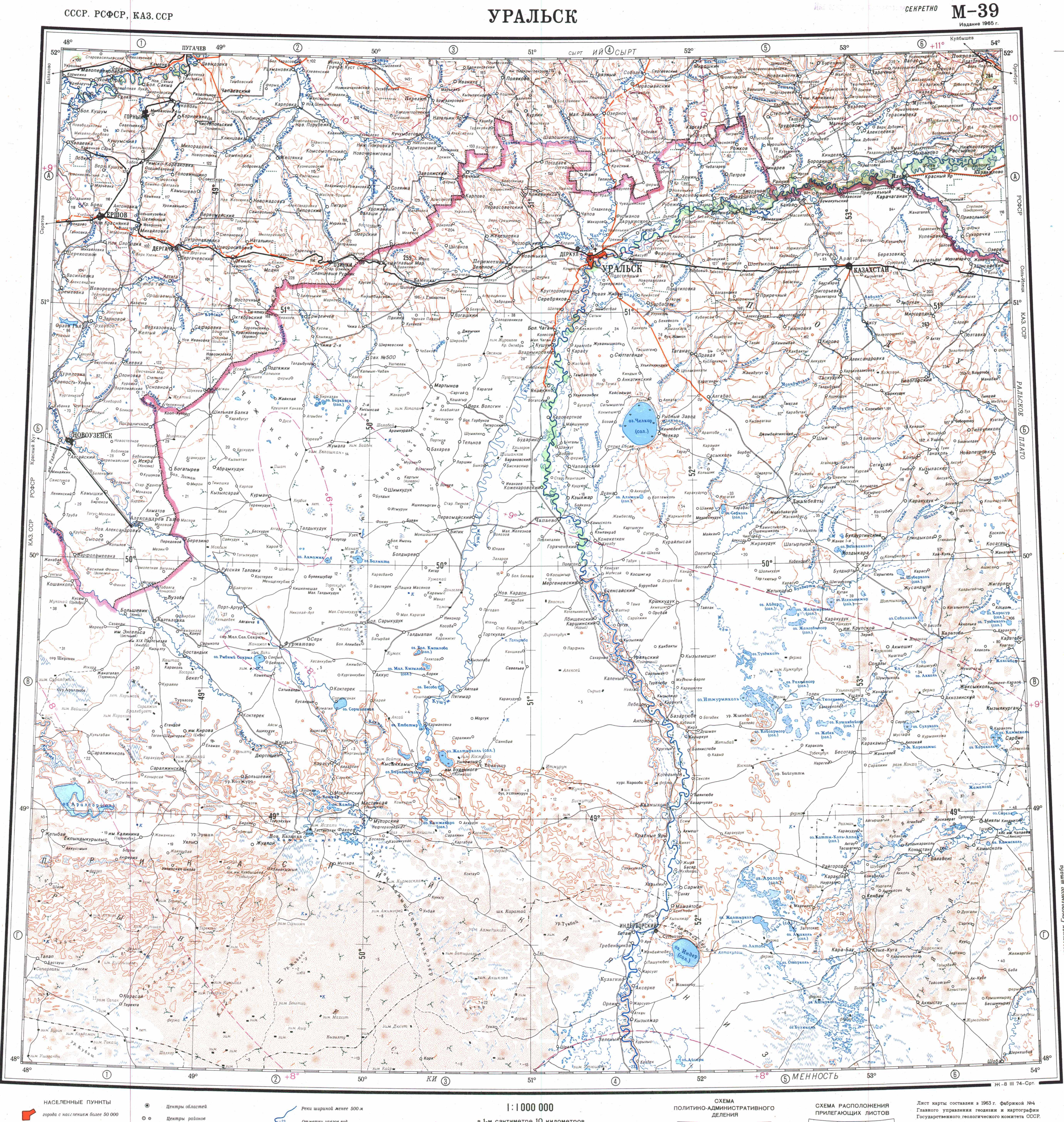
The Ural rises near Mount Kruglaya in the Ural Mountains, flows south parallel and west of the north-flowing Tobol, through Magnitogorsk, and around the southern end of the Urals, through Orsk where it turns west for about , to Orenburg, where the river Sakmara joins. From Orenburg it continues west, passing into Kazakhstan, then turning south again at Oral, and meandering through a broad flat plain until it reaches the Caspian a few kilometers below Atyrau, where it forms a fine 'digitate' (tree-like) delta.
The Ural, also known as the Yaik , is a river flowing through Russia and Kazakhstan in the continental border between Europe and Asia. It originates in the southern Ural Mountains and discharges into the Caspian Sea. At , it is the third-longest river in Europe after the Volga and the Danube, and the 18th-longest river in Asia. The Ural is conventionally considered part of the boundary between the continents of Europe and Asia.
The Ural rises near Mount Kruglaya in the Ural Mountains, flows south parallel and west of the north-flowing Tobol, through Magnitogorsk, and around the southern end of the Urals, through Orsk where it turns west for about , to Orenburg, where the river Sakmara joins. From Orenburg it continues west, passing into Kazakhstan, then turning south again at Oral, and meandering through a broad flat plain until it reaches the Caspian a few kilometers below Atyrau, where it forms a fine 'digitate' (tree-like) delta.
Hydrography
The river is mostly fed by melting snow (60–70%); the contribution of precipitation is relatively minor. Most of its annual discharge (65%) occurs during the spring floods, which occur in March and April near the mouth and in late April through June upstream; 30% drain during the summer and autumn and 5% in winter. During the floods, the river widens to above near Uralsk and to several tens of kilometers near the mouth. Water level is highest in later April upstream and in May downstream.
Its fluctuation is in the upper stream, in the middle of the river and about in the delta. The average water discharge is near Orenburg, and at the Kushum village, which is from the mouth. The maximum discharge is and the minimum is . Average turbidity is at Orenburg and near Kushum. The river freezes at the source in early November and in the middle and lower reaches in late November. It opens in the lower reaches in late March and in early April in the upper reaches. The ice drift is relatively short.
The average depth is near the source, and it increases in the middle reaches and especially near the mouth. The density of underwater vegetation also increases from the source to the mouth, so does the richness of the fauna. The bottom in the upper stream is rocky, with pebble and sand; it changes to silt-sand and occasionally clay downstream. The basin is asymmetrical – its left side from the river is 2.1 times larger in area than the right side; however, the right side is more important for feeding the river.
The density of the tributaries is 0.29 km/km 2 in the right and 0.19 km/km 2 in the left side of the basin. The right-side tributaries are typical mountain rivers whereas the left-side tributaries have flatland character. About from the mouth there is a dangerous spot for shipping called Kruglovskaya prorva ( meaning Kruglovsk abyss). Here the river narrows and creates a strong vortex over a deep pit. The climate is continental with frequent and strong winds. Typical annual precipitation is .
Fauna
The wetlands at and near the delta of the Ural River are especially important to migrating birds as an important stop-over along the Asian flyway.
They host many endemic and endangered species, such as great white pelican, Dalmatian pelican, pygmy cormorant, cattle egret, little egret, greater flamingo, white-headed duck, ferruginous duck, Eurasian spoonbill, glossy ibis, houbara bustard, great black-headed gull, slender-billed gull, squacco heron, common crane, demoiselle crane, slender-billed curlew, black stork, red-breasted goose, lesser white-fronted goose, lesser kestrel, whooper swan, tundra swan, osprey, pallid harrier, short-toed eagle and many others.
The pygmy cormorant was observed sporadically before 1999 and more regularly after that. Cattle egret is observed since 1990 between April and September (as most other migratory birds in this area), with the total population of several dozen couples. It feeds on frogs, mollusks and small fish. Upstream, there are more of the resident bird species, such as grouse, wild pigeon and partridge. Ural River is also important for many fish species of the Caspian Sea which visit its delta and migrate upstream for spawning.
In the lower reaches of the river there are 47 species from 13 families. The family Cyprinidae account for 40%, sturgeon and herring make up 11%, perch and herring 9% and salmon 4.4%. The main commercial species are sturgeon, roach, bream, perch, carp, asp and Wels catfish. The rare species include Caspian salmon, sterlet, white salmon and kutum. In the delta of the river and nearby regions live about 48 animal species belonging to 7 orders; most common are rodents (21 species) and predators (12).
Among them, Bobrinski's serotine and marbled polecat are endemic. Key species are raccoon dog, muskrat (appeared recently), European hare, house mouse, brown rat, and wild boar. Wild boars had a density of 1.2–2.5 per hectare in 2000 and are hunted commercially. Others include elk, fox, wolf, dwarf fat-tailed jerboa, great gerbil, northern mole vole and saiga antelope. The Turkmenian kulan (Equus hemionus kulan) used to live at the Ural River. It might be extinct from that region.
The reptiles are represented by bog turtles, common water snakes, rat snakes and sand lizard. Bog turtles are found in all waters. Common water snakes live on the banks of canals. Rat snakes and sand lizards are few and inhabit relatively high areas of land. Two more reptiles, Caspian whipsnake and Coluber spinalis, are extremely rare. Among amphibians common are lake frog and green frog. With an estimated 5,000 to 10,000 species, insects exceed all other animals of the region by diversity and biomass.
Terrestrial and aquatic insects make up a significant proportion of the diet of birds. Many species are parasitic on birds and transmit infection. Other dominating inhabitants of the river are protozoa, rotifers, Cladocera and copepods. Mollusks are mostly represented by gastropods and bivalves. File:Loeffler.jpg|Eurasian spoonbill File:Ellobius talpinus.jpg|Northern mole vole File:Rhombomys opimus 1.jpg|Great gerbil File:Marbled polecat.jpg|Marbled polecat File:Sturgeon.jpg|Sturgeon
Industry
Water from the upper reaches of the Ural River is used to supply the prominent Magnitogorsk (Magnitogorsk Iron and Steel Works, built in the early 1930s) and Orsk-Khalilovsk metallurgical plants, and the low reaches are used for irrigation. Two reservoirs were created near Magnitogorsk, and there is a hydroelectric plant near the village of Iriklinskaya with the corresponding reservoir. Below Uralsk, there is another reservoir and the Kushumsky channel. The river is navigated up to Uralsk and there is a port in Atyrau. Fishery is well developed; the commercial fish species include sturgeon, perch, herring, bream, carp and catfish. The delta of Ural River accounts for about half of the fish catchment in Kazakhstan. Also widespread is agriculture, especially growth of melons and watermelons. The city of Atyrau is a major oil producing center of Kazakhstan.
Notes
References
Bibliography
Text derived from https://en.wikipedia.org/w/index.php?oldid=1378008535 under CC BY-SA 4.0; modifications have been made.