Vinland Map
≈ 7 min read
Names in other languages
No names in other languages are held for this entry yet.
Article bodies are English and are not machine-translated. A name in another language is not a translation of the article.
The Vinland Map is a 20th-century forgery purporting to be a 15th-century mappa mundi with unique information about Norse exploration of North America. The map first came to light in 1957 and was acquired by Yale University. It became well known due to the publicity campaign which accompanied its revelation to the public as a "genuine" pre-Columbian map in 1965. In addition to showing Africa, Asia and Europe, the map depicts a landmass south-west of Greenland in the Atlantic labelled as Vinland (Vinlanda Insula).
The map describes this region as having been visited by Europeans in the 11th century. Although it was presented to the world in 1965 with an accompanying scholarly book written by British Museum and Yale University librarians, nonetheless historians of geography and medieval document specialists began to suspect that it might be a fake as soon as photographs of it became available. Later chemical analyses identified one of the major ink ingredients as a 20th-century artificial pigment.
In 2018, after several investigations and many years of debate, specialists at Yale declared that the latest scientific and historical research had conclusively established that it was a modern forgery. The map remains in Yale University's Beinecke Rare Book and Manuscript Library as part of its collection.
"VMTR 95"
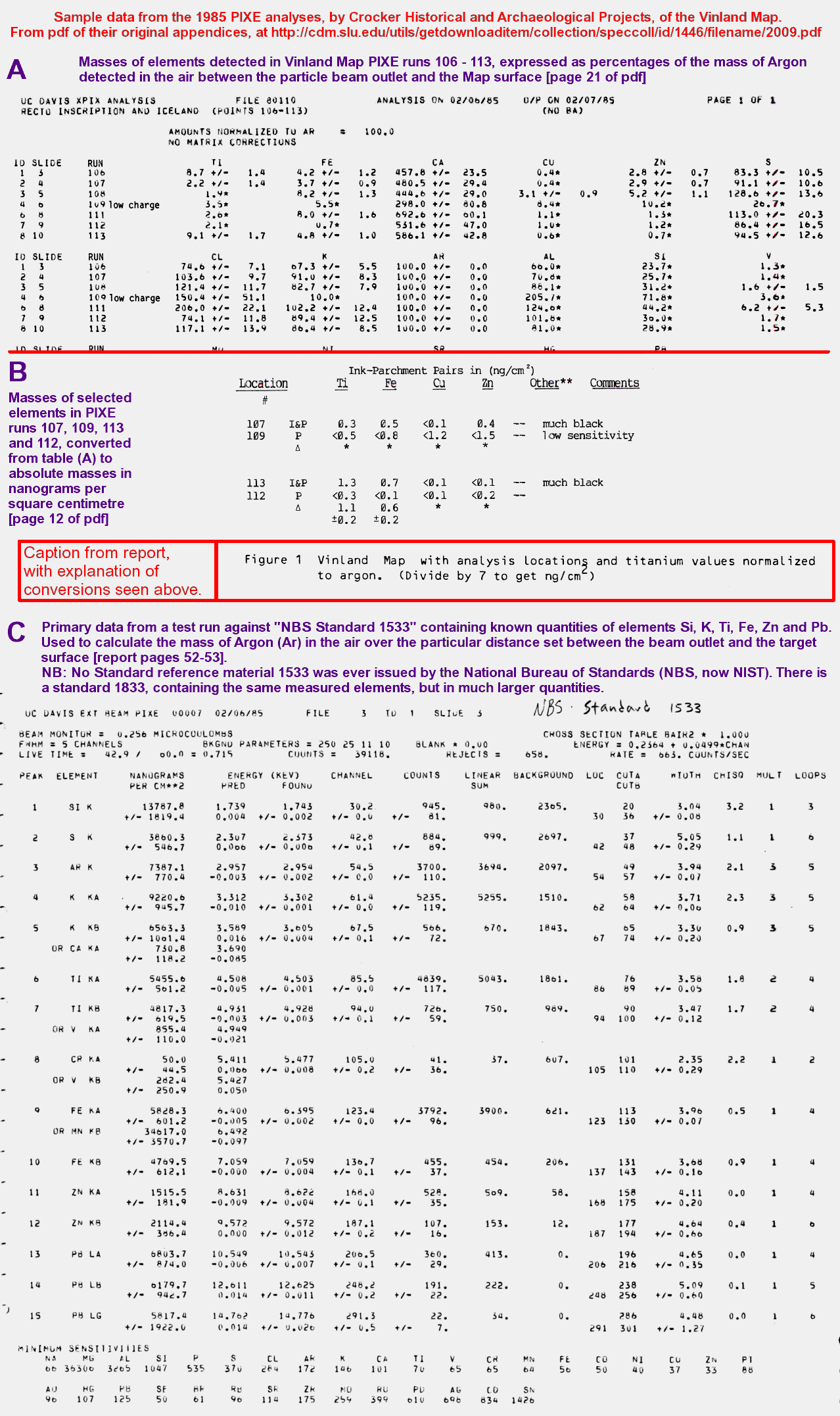
The expanded 30th anniversary edition of the 1965 official book, The Vinland Map and the Tartar Relation, was notable for its exclusion of most of the evidence against the map's authenticity, concentrating instead on vindications by George Painter, and Thomas Cahill with colleague Bruce Kusko (in which they claimed specifically that they had not analyzed the loose particles they took from the map at the time of their PIXE research), but it did reprint an essay written in 1989 by the original book dealer Laurence Witten.
He stated that, when the McCrone investigation concluded the map to be a forgery in 1974, he was asked by Yale to reveal its provenance as a matter of urgency, and to discuss the possible return of Mr Mellon's money. He replied that he had no idea where the map came from, beyond Ferrajoli (who was convicted of theft shortly after the sale, and died shortly after release from prison). On the subject of the money, he said he could not pay it all back because he had paid agreed shares of his profit to Ferrajoli and to another dealer who had introduced him.
For his part, Mellon did not ask for the return of any money. The essay also revealed that Witten had, on Ferrajoli's recommendation, met with Irving Davis after buying the map volume in 1957. Regardless of the controversy, the map, which had been valued for insurance purposes at over $750,000 in the 1960s, was claimed in 1996 to be worth $25,000,000.
Identification as a forgery, 2018
As controversy has swirled around the map almost since its acquisition, authorities at Yale University chose not to comment on the authenticity of the parchment document. In 2002, Yale librarian Alice Prochaska commented that "We regard ourselves as the custodians of an extremely interesting and controversial document... and we watch the scholarly work on it with great interest." In 2011, Yale's Chester D. Tripp Professor of History, Paul Freedman, expressed his view that the map was "unfortunately a fake".
At the 2018 Vinland Map Symposium, Yale conservation scientist Richard Hark revealed the results of new global chemical analyses of the map and the Tartar Relation, which established that the ink lines of the map contain varying amounts of anatase "consistent with modern manufacture". So too do two small patches on the first page of the Tartar Relation, where the original iron-gall ink appears to have been erased and replaced.
Raymond Clemens, Curator of Early Books and Manuscripts at Yale's Beinecke Rare Book & Manuscript Library, considers that the latest historical and scientific research proves "beyond a doubt" that the Vinland map "was a forgery, not a medieval product as it claimed to be." In a March 2019 article, Clemens highlights the fact that "historical investigations by John Paul Floyd have revealed that the Vinland Map is based not on Bianco’s 1436 map, but on a printed facsimile map made in 1782.
Floyd discovered this by noting mistakes in the 1782 map that were replicated on the Vinland map, but could be found nowhere else." Furthermore, the map has been studied at the Beinecke Library using new technology. "In the case of the Vinland map we were able to prove... [the map] was clearly a 20th century fake." Despite the map's forged origins, Clemens stated that the map would remain at the Beinecke Library, as it had "become an historical object in and of itself."
See also
Antillia L'Anse aux Meadows, the only confirmed Norse site in North America outside of Greenland Piri Reis map Skálholt Map Weimar map
Notes
References
Further information
Archived at Ghostarchive and the Wayback Machine :
Text derived from https://en.wikipedia.org/w/index.php?oldid=1366008750 under CC BY-SA 4.0; modifications have been made.