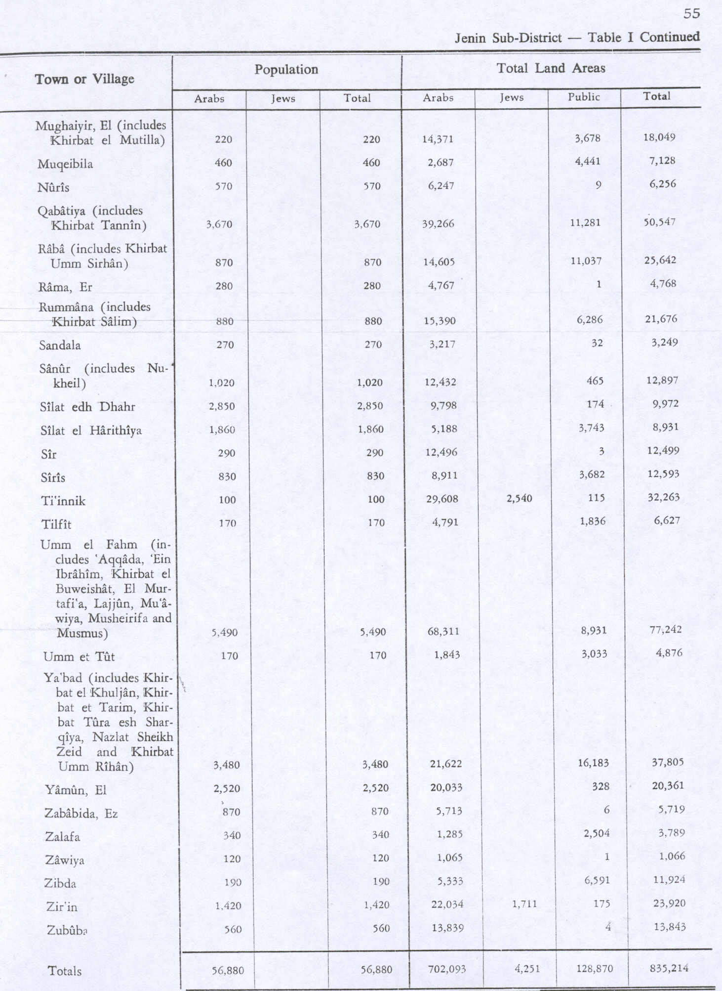
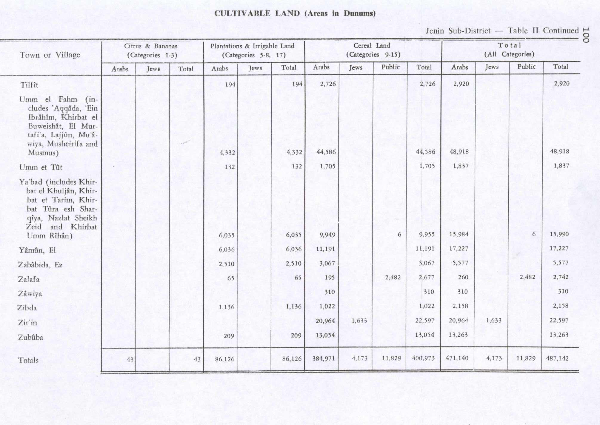
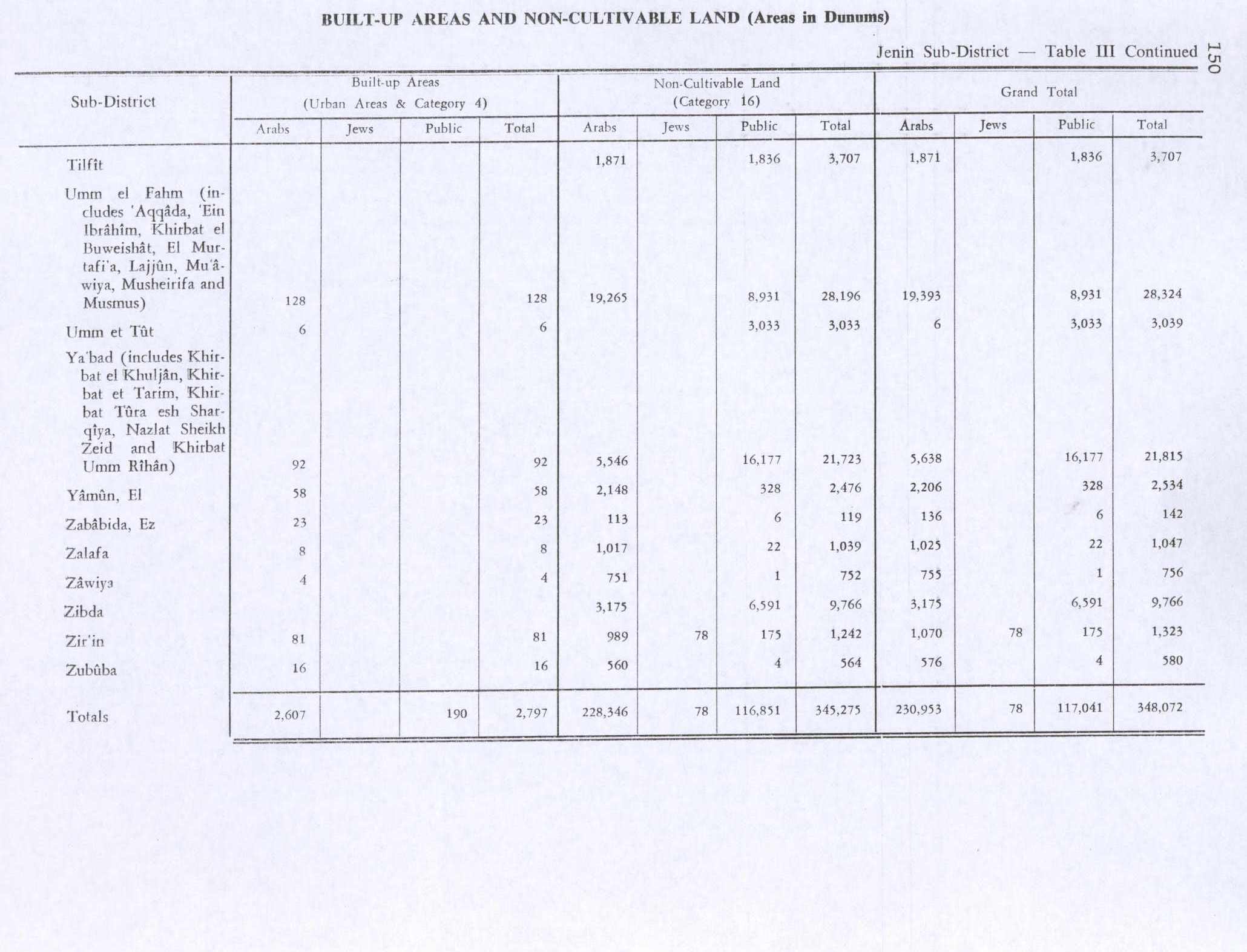
Zalafa
≈ 4 min read
Names in other languages
No names in other languages are held for this entry yet.
Article bodies are English and are not machine-translated. A name in another language is not a translation of the article.
Zalafa ( , ) is an Arab village in Israel's Haifa District. The village is in the Wadi Ara area of the northern Triangle, northeast of Umm al-Fahm. Since 1996, it has been under the jurisdiction of the Ma'ale Iron local council whose headquarters is in the village. The village is divided into three neighborhoods: East, West and al-Murtafi'a. In mid-2016, Zalafa's population was 4,639, all of whom are Muslim.
Zalafa ( , ) is an Arab village in Israel's Haifa District. The village is in the Wadi Ara area of the northern Triangle, northeast of Umm al-Fahm. Since 1996, it has been under the jurisdiction of the Ma'ale Iron local council whose headquarters is in the village. The village is divided into three neighborhoods: East, West and al-Murtafi'a. In mid-2016, Zalafa's population was 4,639, all of whom are Muslim.
History
According to archeological evidence, Zalafa location has been settled continuously since the Iron Age, but with a decline in the Ottoman era. Building foundations, burial tombs, potsherds from the Byzantine era and an ancient well can be found under the village.
Ottoman Empire
In 1870, French explorer Victor Guérin found Zalafa "almost completely deserted", and in the 1870s it was described as "a small ruined village with a well" by the PEF's Survey of Western Palestine (SWP). In 1870/1871 (1288 AH), an Ottoman census listed the village in the nahiya of Shafa al-Gharby. During the 19th and first half of the 20th century, Zalafa was one of the settlements of the so-called "Fahmawi Commonwealth" established by Hebronite clans belonging to Umm al-Fahm.
The Commonwealth consisted of a network of interspersed communities connected by ties of kinship, and socially, economically and politically affiliated with Umm al Fahm. The Commonwealth dominated vast sections of Bilad al-Ruha/Ramot Menashe, Wadi 'Ara and Marj Ibn 'Amir/Jezreel Valley during that time. The village's clay and straw houses were built close to each other for security reasons. Clan divisions were reflected in the distribution of the houses.
Zalafa's residents drew water from nearby springs and the village lacked basic services such as schools, clinics, local government, banks, etc. Following the Jewish migration to Palestine, many of Zalafa's residents worked in Jewish-owned fields and settlements. In addition to being a new source of income, this work experience instilled in the residents advanced skills that improved their way of life.
Geography
The village is situated on a high hill, which allowed the residents to better defend themselves. It borders the Megiddo Regional Council to the north, with Givat Oz to the northeast and the municipal boundaries of Umm al-Fahm on the south. It is situated west of the West Bank. Zalafa's soil is fertile with an abundance of underground water, which aided the development of agriculture, the village's primary source of income and sustenance in its early history. Wadi Zalafa, a stream of the Kishon River, flows through the center of the village, dividing it into two parts: Zalafa al-Gharbiyya (=West) and Zalafa al-Sharkiyya (=East). North of the village is another stream that flows into the Kishon River as well.
Demographics
According to the 2008 census of the Central Bureau of Statistics (CBS), Zalafa had 4,000 residents, 99.8% of them Muslim. 45.0% were under age 17, 51.3% were aged 18–64 and 3.7% were over 65. The median age was 20.
Economy
According to the 2008 CBS census, 29% of residents were in the annual civilian labour force; 49.3% of the men and 8.2% of the women. 53.2% of the male workforce worked in construction; 9% in manufacturing; 8.2% in wholesale, retail trade, and Auto Mechanism; 7.5% in transport, storage, and communications; and the rest in other sectors. 88.9% of the female workforce worked in education and 11.1% in transport, storage, and communications.
Sports
Zalafa has a local football team called "Hapoel Bnei Zalafa", participating in Liga Bet. The team hosts matches in a soccer fields located in Umm el-Fahm.
See also
Arab localities in Israel
References
Bibliography
External links
Welcome To Zalafa Welcome To al-Murtafi'a Survey of Western Palestine, Map 8: IAA , Wikimedia commons
Text derived from https://en.wikipedia.org/w/index.php?oldid=1378488249 under CC BY-SA 4.0; modifications have been made.